Computer Vision in Autonomous UAV: Revolutionizing Aerial Intelligence
In modern day, autonomous UAVs (unmanned aerial vehicles) are responsible for a myriad of very important tasks, from precision agriculture to war efforts. It is now commonplace in many different areas of ordinary life, but how exactly can they handle themselves alone, recognizing terrains and flying without human assistance? Find out here!
What is Computer Vision and Why It Matters for UAVs
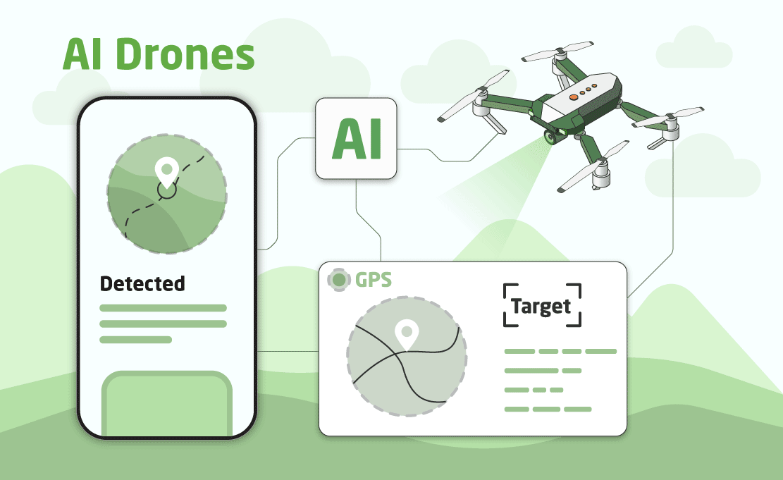
The artificial intelligence area of computer science has many subdivisions, such as machine learning, natural language processing, robotics, etc, and computer vision is also among these. It is the area that studies how computers can process images, either pictures, live streams, or videos, understand the greater context, and work similarly to actual human vision. It is, then, particularly important for the functioning of unmanned aerial vehicles. As they should fly on their own, with as little human interference as possible, the machine must understand its surroundings and act accordingly, avoiding obstacles and aiming towards only its actual target.
As UAVs are usually responsible for extremely important and sensitive tasks, every single mistake can and very probably will cost lives during the critical missions they run. So, because of this, computer vision algorithms must be as well-made and optimized as possible, resilient to failures, and know how to deal with unexpected situations. They’re mission-critical, and each step of the development and training process must be carefully planned and thought-out; that’s why, in current days, this area of study and development is so highly esteemed and valued.
Key Applications of Computer Vision in Autonomous UAVs
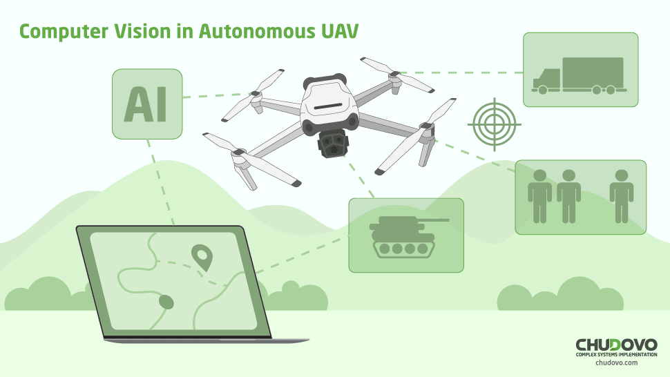
Computer vision services are the basis of the functioning of autonomous unmanned aerial vehicles, exercising direct influence over their motion controls, trajectory planning, and understanding of their current environment and situation. Still, it is most noted in some very sensitive tasks, such as obstacle detection, target tracking, industrial inspection, agricultural monitoring, navigation without GPS, search and rescue, etc.
Let’s dive a bit further into some of these:
Obstacle Detection and Avoidance
The drone uses cameras and/or depth sensors to evaluate the terrain through detection algorithms, such as CNNs, YOLO, and SSD. The images are then processed in real-time, allowing the system to “see” shapes, borders, distances, and environmental patterns. So, when something is up close, such as a wall or a tree, the algorithm will very quickly calculate an alternative route to avoid hitting it, using techniques such as optical flow, SLAM (Simultaneous Localization and Mapping), and depth calculation.
Object Tracking and Recognition
Understanding what exactly the objects seen by a camera are is a process a lot more complex than requiring machine learning algorithms and sometimes even special sensors. The drone must be trained with AI models, implementing object recognition models such as Kalman filters and SORT or DeepSORT, to be able to discern different shapes and colors and understand the context with that. Then, when the camera sees an object that is recognized as its target, it can activate a tracking mechanism in the UAV and adjust its functioning towards it, be it following, spraying pesticides, sharing location, etc.
3D Mapping and Terrain Analysis
UAVs are highly valuable in terrain analysis and in creating 3D models of terrain. It uses stereo vision to take pictures of the ground and, by comparing different pictures, can understand depth and terrain relief, or it can use LiDAR sensors to send laser pulses and measure how long they take to come back. It uses techniques such as photogrammetry, structure from motion (SfM), LiDAR Point Clouds, and Semantic Segmentation to understand pixels, calculate distances, identify key points in a map, etc. That’s a really powerful usage for UAVs, as they can spare months of manual work while also creating a much more reliable 3D scan of a terrain. It is very useful in a myriad of contexts in planning how to unfold operations on fields and grounds.
Benefits of Integrating Computer Vision in UAVs
Integrating computer vision into UAVs offers many advantages, to such an extent that it is not worth sparing the expense. Whenever it is possible, unmanned aerial vehicles must use computer vision, under the risk of becoming worthless in a short timespan or even from the very beginning. Here are some examples of the many advantages of it:
- Reduction of operational costs: With computer vision, drones can operate alone, with no need for a specialized pilot or real-time human operator. It eliminates the need for repetitive manual missions, saving time, fuel, and manpower. For instance, an agricultural drone can inspect several hectares in minutes, with no need for a field team.
- Improved autonomy: Drones with computational vision make decisions in real time, such as avoiding obstacles, changing courses, checking which path is the best, etc. It allows them to act in unknown or unmapped regions, or even areas without a GPS signal, using only its camera and sensors. That’s especially useful if a drone needs to navigate through complex zones with no need for remote control, such as buildings, forests, or urban areas.
- Improved real-time decision-making: Through neural networks and detection algorithms, the drone can recognize patterns, identify objects, and understand the environment while it flies. It allows the drone to be autonomous and make choices such as avoiding areas, understanding targets, recognizing threats, etc.
- Application in critical areas without human intervention: With computer vision, drones can reliably fly in places of great danger, whether they are remote or inaccessible to human beings. Some examples are disaster zones, contaminated regions, conflict areas, etc. It can save lives and prevent catastrophes, or help contain damage in endangered regions, making them extremely valuable.
Challenges and Limitations of Computer Vision in UAVs
As we have discussed extensively, computer vision offers a myriad of advantages, but it still has its operational and technical limitations. Unexpected situations can severely injure the capability of the algorithms to understand the context of where they are, possibly leading to the loss of the UAV. Some classical situations that represent danger are:
- Poor lighting: The lack of lighting in an environment may impair the visibility of the drone’s cameras or even deny it entirely, rendering the computer vision system useless. With it, the drone’s flying capability is seriously threatened or even entirely prevented from happening. Because of this, the quality of the lighting must be very well planned before flying an unmanned aerial vehicle.
- Limited computational power inside the drone: The drone’s internal computer might not be as powerful as needed for blazing-fast video processing. This can lead to throttling in the computer vision system, which then leads to undesired slow responses, especially when there are many things happening at the same time. It can compromise the result of a whole operation, putting lives at stake in some very sensitive edge cases.
- Adverse weather: Unpredicted weather changes might lead the drone to a state of confusion, or might damage the systems and sensors responsible for allowing the computer vision to happen. Though the drone has to be capable of resisting such contingencies, sometimes things turn out much worse than previously thought, leading to severe damage to the vehicle. Such damage can compromise its capability to coordinate itself in the environment, leading to weird behavior and even sudden crashes or collapses.
Still, even though these challenges are sometimes hard to bypass, they’re very well known and will gradually be solved as time goes by. The frontline to attack such cases is led by embedded AI systems and the usage of edge computing, allowing the internal computer to do more with less computing. A well-placed NPU (neural processing unit) to run an AI model might be worth the same amount as a much more expensive upgrade in other parts of the UAV, for instance. That’s the power of cutting-edge technology applied to these very sensible vehicles.
The Future of Autonomous UAVs with Advanced Vision Systems
The future is bright for unmanned aerial vehicles and their different use cases, as computer vision systems become more and more advanced and automated. As new technologies are developed, these drones become more advanced and also cheaper to maintain, train, and use; to exemplify, here’s a list of what is expected for the near future:
- Use of Embedded Deep Learning: The future of autonomous aerial vehicles depends on the use of AI models embedded directly into the device. With this, deep learning will run in the UAV itself, reducing latency and allowing for ultra-fast responses. The technology already exists, with chips such as NVIDIA Jetson, Qualcomm RB5, and ARM chips with AI cores (neural processing units, or NPUs) being capable of creating a very legitimate local AI environment.
- Efficient Neural Networks: Models such as YOLOv8 (You Only Look Once) or MobileNet are light and optimized for embedded systems. They allow for object detection in real time, scene classification, and tracking with minimal hardware consumption. This is a guarantee that even the lightest, simplest drone will be able to run a language model, even though it might not be the biggest one.
- Integration with 5G/6G for Edgle/Cloud Offloading: The popularization of 5G and 6G in the future will allow for quick communication with external servers, fostering blazing-fast data transfers. With this, heavier AI data processing can be made in more powerful machines in servers, and the UAV will quickly communicate with them; complex data analysis will be made in real-time and with low latency, etc. So, while on one hand the internal chips of the drone will be more powerful, the communication with external environments will also become faster, in a win/win all-around situation.
- Expansion to Smart Cities: Autonomous drones are certainly going to dominate the aerial landscape in big cities in the near future, as they are already starting to do. Medicines, food, replacement parts, etc, can quickly and steadily be delivered by UAVs, improving urban logistics and releasing precious space in urban traffic. And, powered by computer vision, they are sure to be able to be self-sufficient and handle themselves well in the middle of tall buildings or traffic from other drones.
Because of this and many more, it is notable that this technology, though already very mature, is still nowhere near its full potential. Small drones are still very limited due to little computing processing; and, as AI develops, it will soon be able to run smoothly in the tinniest of machines, with 5G delivering the low latency it needs so much. In this market, the sky is, quite literally, the limit.
How Businesses Can Leverage Computer Vision in UAV Projects
Enterprises can benefit from computer vision in unmanned aerial vehicles projects in several different ways. They can automate critical tasks, collect data with high precision, reduce operational risks, and even create new business models that revolve around autonomous aerial services.
For instance, in agritech, drones detect plagues or dry lands to apply defenses with precision. In the energy industry, drones can inspect eolic turbines and solar panels with embedded visual analysis, bringing instant feedback and understanding of problems and situations. On retail, lastly, drones are slowly being implemented as delivery robots to automate this task and remove the need for a paid employee.
There are, then, endless ways of using autonomous drones, and their use cases cover a huge span of different markets. Anything that is somewhat physical and involves movement over large areas and visualization of something can, then, be automated with them.
Final Thoughts
With all of this in mind, unmanned aerial vehicles are one of the most impressive technological innovations of modern times, most of all when they implement computer vision to become fully independent machines, requiring no human intervention. As we have seen, such drones perform very important roles and tasks all around the world and in the most diverse areas, such as war efforts, precision agriculture, civil construction and topography, search and rescue of lost individuals, etc.
Because of this, these drones must implement the most modern algorithms and paradigms available in the market, as their missions sometimes are critical and crucial for several human or animal lives. For instance, in the context of precision agriculture, whole crops can be lost if the drone doesn’t detect a problem in the fields. Or, if it is supposed to help search for lost individuals in catastrophes, the quality of its algorithm to recognize humans will directly impact the lives of several people.
Hence, as artificial intelligence flourishes and becomes more effective and cost-efficient, drones will also become more and more self-sufficient and eliminate error rates. This will lead to a price reduction on the usage and maintenance of such drones, and improvements such as the addition of dedicated NPUs will become cheaper and easier to install.